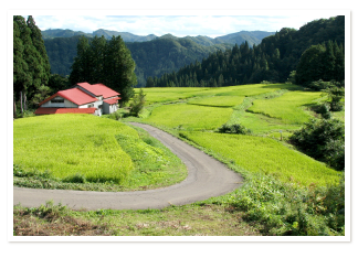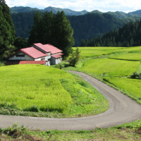


The Fujikoto and Kasuge Rivers descend through the pristine mountain forests of Shirakami Sanchi—an area known for the softness and purity of its waters—before meeting in the town of Fujisato. South of Fujisato, the rivers’ combined flow enters the Yoneshiro River, which empties into the Sea of Japan.
The 56.5-kilometer Fujikoto River originates on Mt. Fujisato-Komagatake (1,158 m), a peak just outside the Shirakami Sanchi World Natural Heritage area. Numerous small tributaries flow into the Fujikoto as it makes its way through Daira Gorge and down to the flatlands of Fujisato. The Fujikoto was once used by foresters to float logs downstream, until train tracks were built to bring timber down from the mountains.
The 36-kilometer Kasuge River flows down from the slopes of Mt. Futatsumori (1,086 m), a peak that lies within the buffer zone of the Shirakami Sanchi World Natural Heritage Site. The Kasuge is the only river in Akita with a drainage basin that lies entirely within the Heritage Site’s protected core zone. The river once flowed unobstructed into town, but the construction of Subari Dam in 1970 flooded the narrow valley through which it ran and created Lake Subari. A campground, picnic area, and restaurant now line the lake’s southeastern shore.
Because of their excellent water quality and unrestricted access to the ocean, the Fujikoto and Kasuge are famous for their sweetfish (Plecoglossus altivelis), known as ayu. Ayu are migratory, and in autumn travel downriver to lay their eggs close to the sea. When ayu fry hatch, they swim to the ocean to live for several months before swimming back upstream in spring. However, damns prevent this migration, and rivers that can support ayu are becoming scarcer. Although the Subari Dam restricts ayu to the lower reaches of the Kasuge, both rivers support ayu populations.
In addition to ayu, the Fujikoto and Kasuge are famous for char (iwana) and cherry trout (yamame). On the Kasuge, fishing is limited to areas downriver of Subari Dam. Fishing permits are required for both rivers, and can be obtained at fishing supply outlets and other shops around Fujisato.
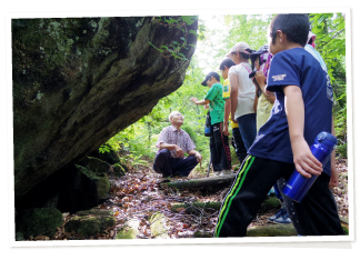
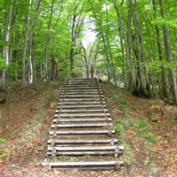
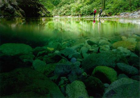
The rivers are also locations for “river trekking,” a warm-weather activity in which hikers traverse a gorge by walking along the bed of a river. River trekkers follow in the footsteps of local residents who once used rivers and streams to traverse Shirakami Sanchi forests due to the lack of footpaths.
-----------------------------------
日本語訳
藤琴川と粕毛川は、高い軟度と透明度で知られている白神山地の原始林を下り、藤里町で合流する。合流点は、藤里町の南部で米代川に入り、さらに米代川は日本海に流れ込む。
長さ56.5kmの藤琴川は、藤里駒ヶ岳(1,158m)にその源を発している。藤里駒ヶ岳は、世界自然遺産白神山地のすぐ外に位置する山である。たくさんの小さな支流が太良峡を通って藤琴川に流れ込み、藤里町の平地へと下ってゆく。山から材木を降ろすための線路が建設される前は、丸太を山から藤琴川の下流へと流して運んでいた。
長さ36kmの粕毛川は、山頂が世界自然遺産白神山地のバッファゾーンにある二ツ森(標高1,086m)の山腹斜面に源を発している。秋田県で唯一の流域を持つ河川である粕毛川は、保護された世界自然遺産コアゾーンに位置する。粕毛川はかつてそのまま町に流れ込んでいたが、1970年に素波里ダムが建設されたことにより、狭い谷が氾濫し、素波里湖が誕生した。現在、南東の湖畔には、キャンプ場、ピクニックエリア、レストランが並んでいる。
藤琴川と粕毛川は、水質が優れており、また海へ自由に行き来できることから、アユが生息していることで有名である。アユは回遊魚で、秋には川を下って海の近くで産卵する。アユは孵化すると海へ移動し、そこで数ヶ月暮らしてから、春になるとまた上流に戻ってくる。しかし、ダムの建設によってアユの移動が制限されたため、アユが生息できる川が少なくなってきている。素波里ダムの建設によって、粕毛川のアユの生息地は下流に限定されているが、どちらの川もアユの個体数を支えている。
藤琴川と粕毛川は、アユのほかにイワナやヤマメも有名である。粕毛川では、素波里ダムの下流域での釣りに限定されている。どちらの川でも入漁許可が必要であり、藤里周辺の釣具店や商店などで取得できる。
川はまた、「沢歩き」スポットでもある。沢歩きは、川床に沿って歩き渓谷を横断するアクティビティで、温暖な気候の時期に行われる。沢歩きでは、歩道がないため、かつて川や小川を利用して白神山地の森を越えていた地元住民たちの足跡をたどる。