


Subari Dam(素波里ダム)
The Subari Dam spans the Kasuge River just south of Lake Subari. Torrential rains that caused severe flooding in 1963 were the impetus for creation of the dam, which was completed in 1970. In addition to being a flood barrier, the dam drives a hydroelectric power generator and provides a water source for irrigation and in times of shortage.
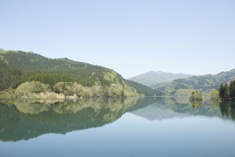
The site chosen for the dam was a particularly narrow point along the Kasuge River valley. The area has long been known for its natural beauty. Sugae Masumi (1754–1829), a traveler and naturalist known for his writings about Akita, visited the area in 1802 and described the scenery as spectacular. The small village of Obiraki was also located in the valley, but was evacuated once construction on the dam began in 1967. It is now submerged beneath Subari Lake.
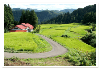
Subari Dam helps to regulate water levels in Fujisato, increasing flow to the lower Kasuge River in times of drought and holding back excess in times of heavy rainfall. Water from Subari Lake is used to irrigate fields in the region; a 20-kilometer pipe carries it to the towns of Noshiro and Mitane. The hydroelectric power plant at the dam generates almost 28 million gigawatt-hours annually.
The dam was also a catalyst for forest preservation efforts in the Shirakami Sanchi area in the 1980s. After Japanese beech trees on the mountains around the dam were cut down, the water level in Subari Lake dropped. This underscored the role of forests—and particularly the water-retentive beech—in regulating the area’s water table and creating a buffer against floods, droughts, and landslides.
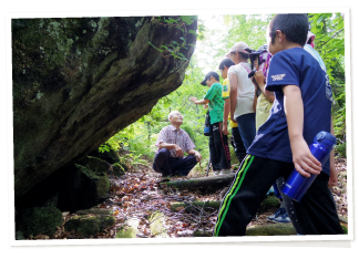
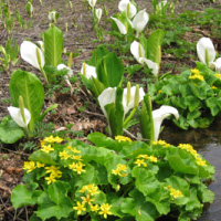
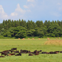
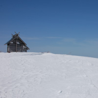
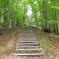
Subari Lake covers an area of 100 square kilometers. The forested slopes surrounding the lake are a rich ecosystem similar to that of the protected zone of the Shirakami Sanchi World Natural Heritage Site. Bears and monkeys can sometimes be spotted in the trees, and among the plant species are many kinds of “mountain vegetables” (sansai), edible wild plants that local people gather. There are campsites on the lake’s eastern shore, as well as the Suffolk no Kan restaurant and a local history museum. The museum offers free wi-fi and has a space designed for remote work.
Subari Dam is a 15-minute drive from the center of Fujisato.
------------------------------------
日本語訳
素波里ダムは、素波里湖のすぐ南にある粕毛川に架かっている。1963年の集中豪雨は深刻な洪水を引き起こしたが、このことがダムの建設を後押しすることとなり、1970年に完成した。このダムは、防潮堤であることに加え、水力発電を駆動させ、灌漑用および水不足時の水源を提供している。
ダムに選ばれた場所は、粕毛川の渓谷沿いの特に狭い地点だった。この地域は、長い間その自然の美しさで知られている。秋田についての著述で知られる旅人で自然愛好家の菅江真澄(1754~1829)は、1802年にこの地域を訪れ、目を見張る景色であると表現した。大開集落がこの谷にあったが、1967年にダムの建設が始まると移転した。この集落は現在は素波里湖に沈んでいる。
素波里ダムは藤里町の水位調節に役立ち、干ばつ時には粕毛川下流への流れを増大させ、大雨の時には洪水を貯める。素波里湖の水は、この地域の畑の灌漑に利用されている。20kmの長さのパイプが能代と三種の町に水を運ぶ。ダムの水力発電所は、年間約2,800万ギガワット/時を発電している。
ダムはまた、1980年代初頭の白神山地地域の森林保全活動のきっかけにもなった。ダム周辺の山岳地帯にあるブナの木が伐採された後、素波里湖の水位が低下した。このことにより、森の役割、とりわけ保水性の高いブナの役割が強調された。それらは地域の地下水面を調節し、洪水、干ばつ、地滑りに対する緩衝材となるのである。
素波里湖の面積は100km²に及ぶ。樹木に覆われた斜面は湖を囲み、世界自然遺産白神山地の保護地域の生態系に似た、豊かな生態系を持つ。木々にはクマやサルが見られることもあり、植物の中には、地元の人が採取する野生の食用植物である「山菜」などがある。湖の東岸にはキャンプ場があり、「サフォークの館」レストランと地域の歴史資料館もある。資料館では無料のWi-Fiを提供しており、リモートワーク用に設計されたスペースがある。
藤里町の中心部から素波里ダムまでは車で15分である。