


(白神山地秋田エリア 小岳・二ッ森・藤里駒ケ岳・岳岱・田苗代湿原・留山)
The 16,971-hectare Shirakami Sanchi World Natural Heritage Site contains the largest remaining primeval beech forest in East Asia. Registered by UNESCO in 1993, it is part of the 130,000-hectare Shirakami Sanchi mountain wilderness that spans Akita and Aomori Prefectures. The Akita portion of the UNESCO site covers over 4,300 hectares.
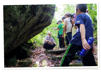
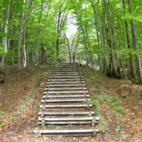
The World Natural Heritage Site is divided into two zones: a protected core zone and a buffer zone. The core area has been largely untouched by humans for over 8,000 years, and access is tightly restricted. The buffer zone encircles the core zone, and there visitors can experience forested terrain similar to that of the core zone.
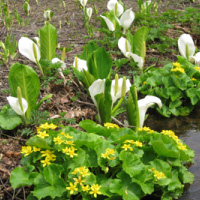
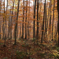
The Japanese beech (buna) is at the heart of Shirakami Sanchi’s rich ecosystem. In addition to sustaining animals and undergrowth, beech trees help regulate water levels in the area—thus mitigating droughts and reducing floods and landslides. Beeches can grow to more than 30 meters in height and live for centuries. Around 100 tree species and hundreds of other plant species are also found in the area.
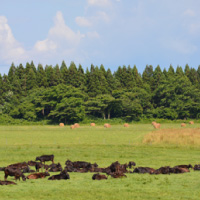
Shirakami Sanchi’s forests contain 35 mammal species, 90 bird species, 13 amphibian species, and 9 species of reptile. These animals include Asian black bears, Japanese macaques, and Japanese serows (shaggy creatures sometimes called “goat-antelopes” that are members of the bovine family).
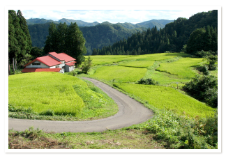
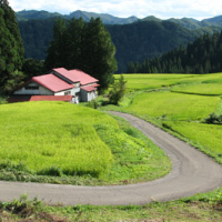
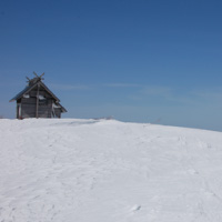
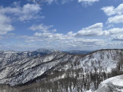
Rivers and tumbling waterfalls cut through the valleys between steep mountain slopes. Some of Shirakami Sanchi’s tallest peaks on the Akita side are Mt. Fujisato-Komagatake (1,158 m), Mt. Futatsumori (1,086 m), and Mt. Kodake (1,042 m). Mt. Tomeyama, less than 180 meters tall, is one of the lowest peaks in the area, but is significant for the prohibition of logging there more than 300 years ago.
----------------------------------------------
日本語訳
16,971ヘクタールの面積を持つ世界自然遺産白神山地には、東アジア最大のブナの原生林が残っている。世界自然遺産白神山地は、1993年にユネスコによって登録された、秋田県と青森県にまたがる130,000ヘクタールの白神山地の原生地域の一部である。
ユネスコ世界遺産地域のうち、秋田県は4,300ヘクタール以上を占めている。
世界自然遺産は、保護されている核心地域と、緩衝地域の2つのゾーンに分かれている。核心地域は8,000年以上にわたって人の手がほとんど加えられておらず、立ち入りが厳しく制限されている。緩衝地帯は核心地域を取り囲むように設けられており、ビジターは核心地域と同じような森林地帯を体験することができる。
ブナは、白神山地の豊かな生態系の中心的存在である。ブナは動物や低木の生命を維持することに加えて、この地域の水量を調整することに役立っている。つまり、干ばつを緩和し、洪水や地滑りを軽減しているのである。ブナは30メートル以上の高さに成長し、何世紀にもわたって生き続ける。この地域には、約100種の樹木とその他数百種の植物も見られる。白神山地の森には、哺乳類35種、鳥類90種、両生類13種、爬虫類9種が生息している。その中には、ツキノワグマ、ニホンザル、ニホンカモシカ(ウシ科に分類され、「カモシカ」と呼ばれることもある毛むくじゃらの生き物)がいる。
山の急斜面の間にできた谷を川や滝が突っ切っている。白神山地の中で、秋田県側で最も高い山は、藤里駒ヶ岳(標高1,158 m)、二ツ森(標高1,086m)、小岳(標高1,042 m)である。標高180メートルに満たない留山は、この地域で最も低い山の1つであるが、300年以上前に伐採が禁止された重要な山である。