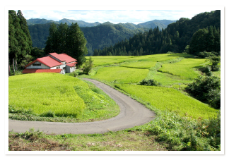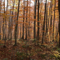


The Fujikoto and Kasuge Rivers begin high in the mountains of Shirakami Sanchi—an area known for the purity and softness of its water—and are exceptionally clean. They converge at the center of the town of Fujisato. From there, their combined flow travels south to the city of Noshiro, where it meets the Yoneshiro River before emptying into the Sea of Japan.
The source of the 56.5-kilometer Fujikoto River is on Mt. Fujisato-Komagatake (1,158 m), a peak north of Fujisato that lies just outside the Shirakami Sanchi World Natural Heritage area. Numerous small tributaries flow into the Fujikoto as it makes its way through Daira Gorge and down to the flatlands of Fujisato.
The 36-kilometer Kasuge River originates on the slopes of Mt. Futatsumori (1,086 m). It is the only river in Akita with a drainage basin that lies entirely within the protected core zone of the Shirakami Sanchi World Natural Heritage Site. The Kasuge once flowed freely into town, but the construction of Subari Dam north of Fujisato in 1970 flooded the narrow valley that now holds Lake Subari, restricting the flow of the river.
Because of their excellent water quality and access to the ocean, the Fujikoto and Kasuge are famous for their sweetfish (Plecoglossus altivelis), a migratory species known as ayu. Both rivers support healthy ayu populations, although the Subari Dam limits ayu to the lower reaches of the Kasuge.
The Fujikoto and Kasuge are also well-known for char (iwana) and cherry trout (yamame) fishing. Permits are required on both rivers and can be obtained at fishing supply stores and other shops around town.
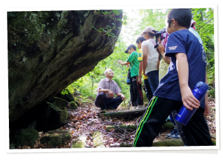
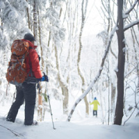
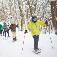
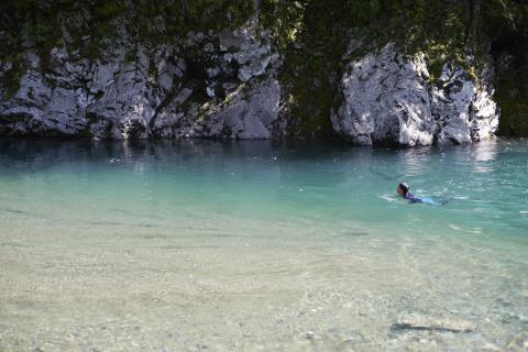
Additionally, the rivers are popular locations for “river trekking,” a warm-weather activity in which hikers traverse a gorge by walking along the bed of a river. The pursuit harks back to a time when people navigated the mountains of Shirakami Sanchi by rivers and streams due to a lack of footpaths.
-----------------------------------
日本語訳
白神山地の山々の高地を源流とする藤琴川と粕毛川は、水の純度と軟らかさで知られ、この上なく清らかである。2つの川は、藤里町の中心部で合流する。そこから能代市まで南下し、米代川と合流し、日本海に流れ込む。
長さ56.5kmの藤琴川の源流は、世界自然遺産白神山地のすぐ外にある藤里町の北の孤峰、藤里駒ヶ岳(標高1,158m)にある。たくさんの小さな支流が藤琴川に流れ込み、太良峡を抜けて藤里町の平地に流れ込む。
長さ36kmの粕毛川は、二ツ森(標高1,086m)の山腹斜面に源を発する。粕毛川は、世界自然遺産白神山地の保護された世界自然遺産コアゾーンにある秋田県で唯一の流域を持つ河川である。粕毛川はかつて縦横無尽に町に流れ込んでいたが、1970年に藤里北部に素波里ダムが建設されたことで、現在素波里湖がある狭い谷が氾濫し、川の流れが制限されてしまった。
藤琴川と粕毛川は、水質が高く、海へ自由に行き来できることから、日本語でアユと呼ばれる回遊魚の生息地として有名である。どちらの川も健康なアユの個体数を維持しているが、素波里ダムができたことにより、粕毛川のアユの生息地は川の下流に限定されている。
藤琴川と粕毛川はイワナやヤマメ釣りでも有名である。どちらの川でも入漁許可が必要であり、近隣の釣具店や、町内の商店などで取得できる。
また、どちらの川も人気の「沢歩き」スポットであり、ハイカーたちは河床を歩いて渓谷を横断する、暖かい気候の時期に行われるアクティビティである。道なき道を行くと、かつて人々が白神山地の山々を川や小川を使って移動していた時代に思いを馳せることができる。