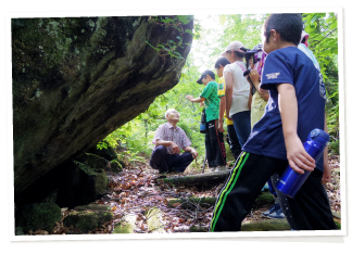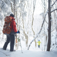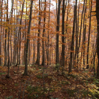


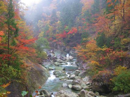
This trail leads to the bottom of Daira Gorge and the bank of the Fujikoto River. It is just under 1 kilometer (round-trip) and descends through a mixed forest of Japanese beech (Fagus crenata) and 200-year-old Japanese cedar (Cryptomeria japonica).
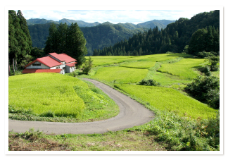
Although Daira Gorge lies outside the core zone of the Shirakami Sanchi World Natural Heritage Site, it shares many characteristics with the protected forest. Spanning 51 hectares, the gorge contains more than 100 tree species. Fruiting plants such as silver vine (Actinidia polygama, a type of kiwifruit) and Japanese wineberry (Rubus phoenicolasius, a species of raspberry) grow along the trail. Japanese wineberry is sometimes called kuma-ichigo, meaning “bear strawberry,” and is a favorite food of the Asian black bears living here.
In addition to bears, Japanese macaque monkeys (Macaca fuscata) and Japanese flying squirrels (Pteromys momonga) make their homes in these woods. Blue-and-white flycatchers (Cyanoptila cyanomelana) and crested kingfishers (Megaceryle lugubris) flit among the trees.
Many large boulders border the trail and line the banks of the Fujikoto River. A short side trail branches off the main trail and leads to the riverside. From the water’s edge, Ihai Rock is visible to the north. This giant stone slab was named for its resemblance to a Buddhist mortuary tablet (ihai). The main trail continues a short way past Ihai Rock, ending in a small clearing with a glimpse of an abandoned railway bridge. The trail used to continue beyond that point, but a landslide in 2013 destroyed the remainder.
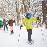
The trail is steep in places and can be slippery. Those who may have difficulty with the trail can best view Daira Gorge from nearby Daira Bridge.
-------------------------------------------------
日本語訳
このハイキングコースは往復1km弱で、太良峡の谷底および藤琴川の川岸へと続いており、ブナと樹齢200年のスギの混交林を抜ける下り坂となっている。
太良峡は、世界自然遺産白神山地の核心地域の外にあるが、保護林の特徴の多くを有している。51ヘクタールに及ぶこの峡谷には、100種以上の樹木がある。ハイキングコース沿いには、マタタビ(キウイフルーツの仲間)やエビガライチゴ(ラズベリーの一種)などの果樹が育つ。エビガライチゴは、「クマイチゴ」と呼ばれることもあり、ここに棲むツキノワグマの好物である。
クマのほかには、ニホンザル、ニホンモモンガがこの森に住んでいる。オオルリやとヤマセミが木と木の間を飛び交う。
多くの巨岩がハイキングコースを縁どり、藤琴川のほとりに並んでいる。短い距離の脇道がメインコースから分かれ、川沿いに続いている。水際から北に位牌岩が見える。この巨大な石板は、仏教の位牌に似ていることからそのように名付けられた。メインコースは位牌岩を少し過ぎたところまで続き、廃線となった路線の鉄橋が見える小さな開けた場所が終点である。かつてはこの地点より先まで続いていたが、2013年の地滑りにより残りの道が崩れてしまった。
ハイキングコースには急勾配で滑りやすい箇所がある。歩くのが難しい場合は、近くの太良橋から太良峡を一望することができる。